Vync

Aadarsh Dubey

@aadarsh365

Aadarsh Dubey@aadarsh365·
Pinned
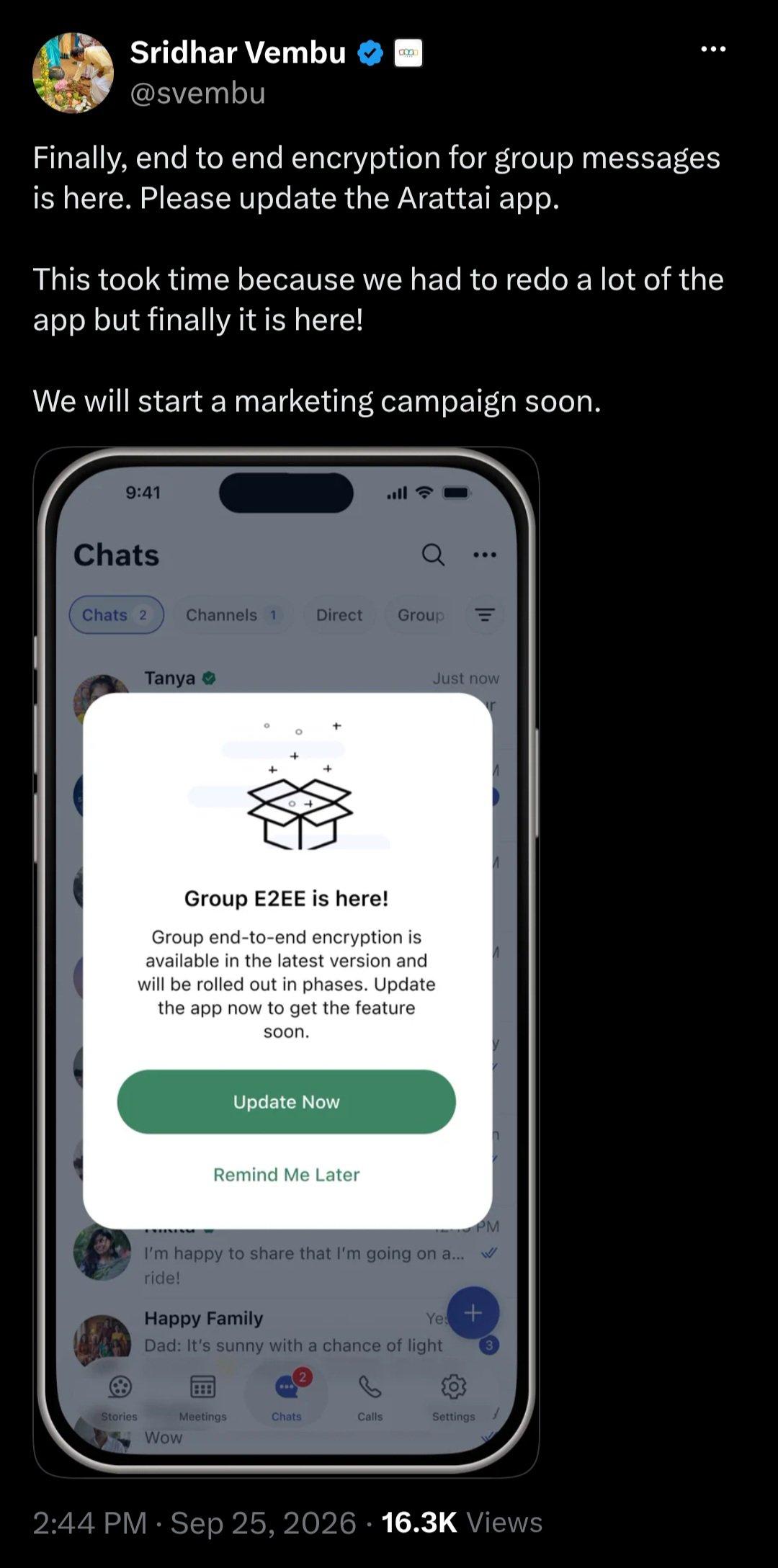
So, Just wait for an app Update and you will get Complete End-to-end Encryption. *Arattai Group E2EE is a reality now*
Media 1
Aadarsh Dubey@aadarsh365·
Pinned
🚆 Strengthening the freight network — one smarter journey at a time! Proud to flag off the Salt Container Train from Shivlakha, moving industrial salt the sustainable way. 🧂📦 A greener, more efficient route that supports Indian industry while keeping our logistics eco-friendly. Greener logistics, brighter tomorrow. 🌱 #NeelkanthGroup #FreightRail #SustainableLogistics #IndianRailways #SaltTransport #GreenerLogistics #MakeInIndia
Aadarsh Dubey@aadarsh365·
Pinned
आप सभी को गणेश चतुर्थी की हार्दिक शुभकामनाएं! वक्रतुंड महाकाय सूर्यकोटि समप्रभ, निर्विघ्नं कुरु मे देव सर्वकार्येषु सर्वदा। Ganpati Bappa Morya! 🙏
Media 1
Aadarsh Dubey@aadarsh365·
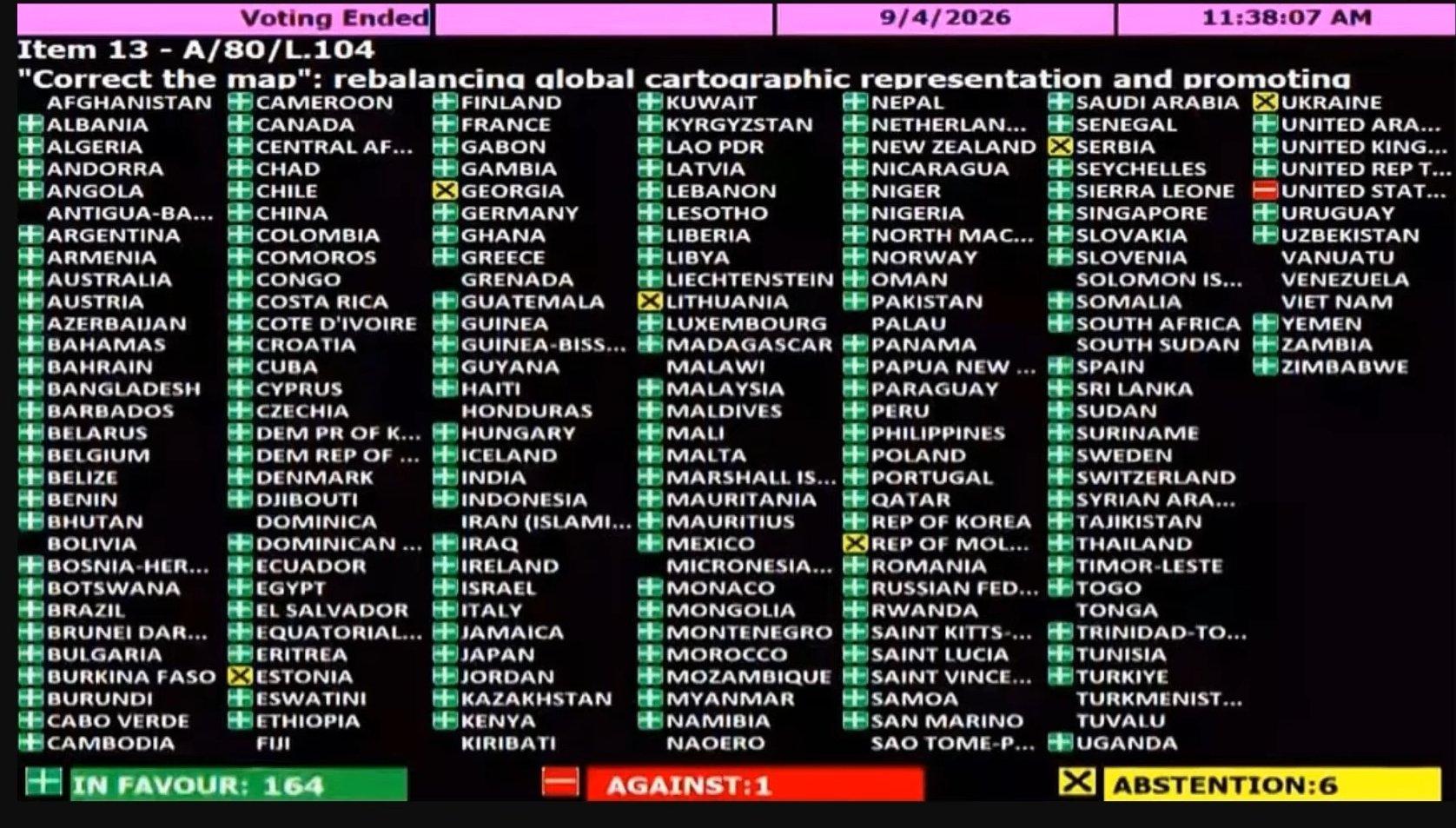
This was voting at UN for *Equal Earth projection map* to be use in world 🌍🗺️
Media 1
Aadarsh Dubey@aadarsh365·
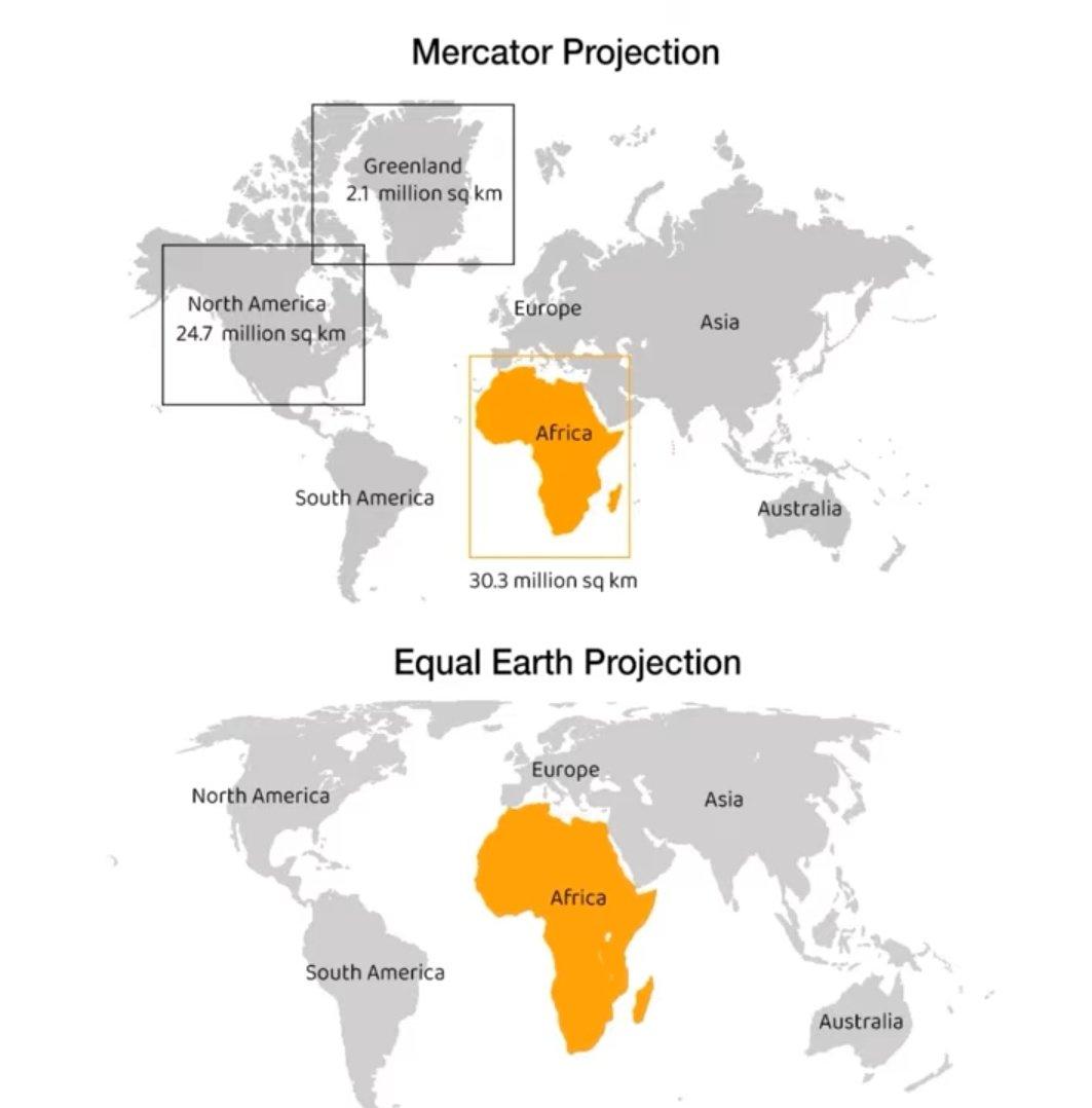
*The UN Just Voted to "Correct the Map" — Here's Why It Matters*🗺️ In a landmark vote at the United Nations General Assembly, 164 nations voted in favour of resolution A/80/L.104, titled "Correct the map": rebalancing global cartographic representation." Just one country voted against, while six abstained. The overwhelming support signals a growing global consensus that the way we draw the world matters. At the heart of the resolution is the Mercator projection — the map most of us grew up seeing. It's useful for navigation, but it massively distorts the size of landmasses. Greenland appears nearly as large as Africa, even though Africa is roughly 14 times bigger. Under Mercator, continents near the equator — home to much of the Global South — are systematically shrunk, while Europe and North America are enlarged. The resolution advocates a shift toward equal-area projections like the Equal Earth map, which preserves the true relative sizes of countries and continents. It's not just a technical correction; it's about representation. When Africa, India, and South America appear smaller than they truly are, it subtly reinforces outdated hierarchies. With 164 to 1, the message from the General Assembly is clear: it's time the map reflected the real world.
Media 1
Aadarsh Dubey@aadarsh365·
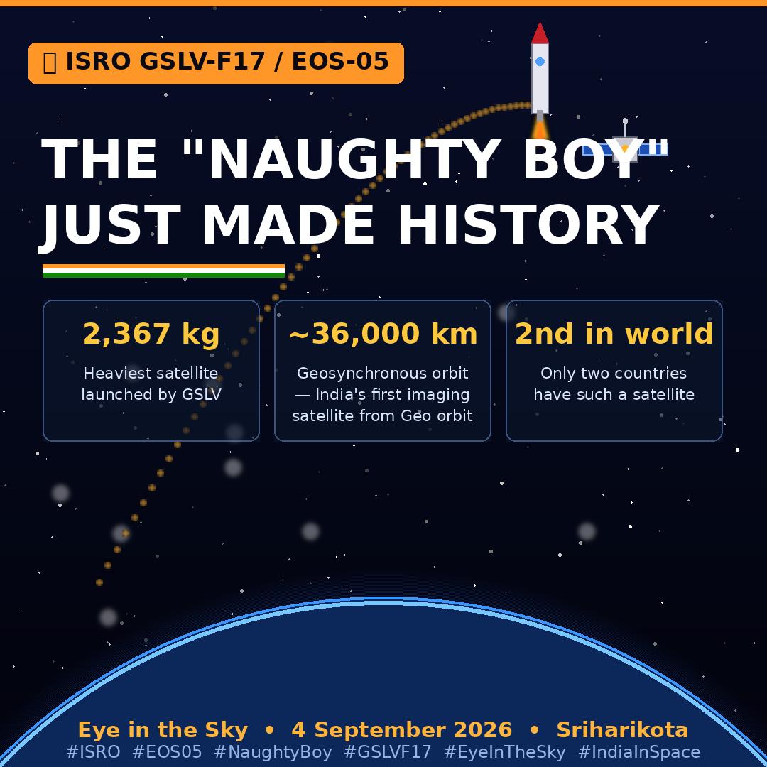
*🚀 ISRO's "Naughty Boy" Just Made History! 🇮🇳* At 2:55 AM on 4 September 2026, ISRO's GSLV-F17 rocket blasted off from Sriharikota and successfully placed the 2,367 kg EOS-05 satellite into orbit — and it performed even better than expected. Why is this huge? *EOS-05 is India's first-ever imaging satellite from geosynchronous orbit, ~36,000 km above Earth.* It will maintain continuous surveillance over Indian territory and surrounding regions — making India only the **second country in the world** to have such a capability. Rightly called the "Eye in the Sky," it will provide near real-time imagery for agriculture, disaster management, environment, and strategic needs. This was ISRO's first successful launch of 2026, ending an eight-month lull after the PSLV-C62 failure. It was also the 107th launch from Sriharikota and the heaviest satellite ever carried by a GSLV. With six more missions planned this year — including the first uncrewed Gaganyaan — ISRO is back in full force. From "Naughty Boy" to national pride. A proud moment for every Indian! 🛰️🇮🇳 #ISRO #EOS05 #NaughtyBoy #GSLVF17 #EyeInTheSky #IndiaInSpace


Media 1